Sunday, January 31, 2016

Friday in the Desert

Five of us went caching on Friday for a couple of VERY specific geocaches. I walked about 6 miles and was very beat by the end of the afternoon. We quit about 3:00 and the other three continued to cache for another hour. I found myself dozing off and on last night and went to bed at an earlier than usual time.

Hubby and I had met Janice at the geocaching event we attended in October. She is from TX. She flew to AZ on Thursday and is staying with her parents who are wintering in Yuma. Janice had asked if she could do a special geocache series with us when she came this weekend. We agreed, but told her she would have to ride in the back seat of the jeep. (Supposedly the jeep seats 4...if the other two are younger than 10!) Janice agreed knowing she would be climbing in and out of that two door jeep. (She is younger than the two of us.)

Another geocaching couple also wanted to do the special geocaching series with us. Jim & Cheri are from our winter resort.

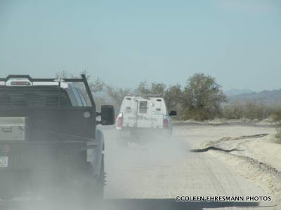
The five of us coordinated plans and on Friday at 8:00 AM, we left town for the desert. (For the two of us, it was our 4th day in the jeep, in the desert, geocaching.) We drove about 30 miles to our starting point. (Many of you wonder what we get when we geocache. As Hubby says, "We get gas receipts.")

Our goal was to find and sign all 51 caches in the AZ State Star geo-art. Several of the others in our little group had trackers to count their steps or distance. I covered more than 5 miles, some of them did 7. (Geocaches must be 524'or more from the next nearest geocache. From the bottom right point of the star, through the center cache, to the diagonal cache just before the line of smileys, was 1.07 miles as the crow flies. One does not walk "as the crow flies" in the desert.)


There we are at the center of the star, signing the final log. We were wearing long sleeves because the containers were usually dropped in scratchy bushes. We wore long pants because of those same scratchy bushes. We were all very hot when we finished walking the desert sand.


The ammo can is the final container; most of the containers will pill bottles containing a piece of paper. So no, we really don't get anything physical when we geocache. It is like a basketball game. A basket scores points. The points are not something physical the team takes with them. There might be 'stuff' in the ammo can or in any cache, but it is usually worthless stuff. 


After the selfie, it was time for a lunch break.


We carry bag chairs in the jeep. Janice and Hubby took advantage of them. Jim and Cheri sat in her Liberty. I had the front of the jeep. It has a very nice bench bumper/fender, big enough for two bums. We were proud of our accomplishment, but we had more to do...


While completing the Star geo-art, we crossed paths with four other geocachers we knew. Annette is on the left. She and Howard were our caching partners in Nebraska in October when we completed the Nebraska State Star and other geo-arts. Kelly is in the center. The husbands were in another area. Cheri is on the right.


The Barry M. Goldwater Range is a training site for the Marines and Air Force. Someone mentioned this weekend that there is not much ground training at this range anymore. We did see Air Force planes throughout the week doing maneuvers.


The rocket launcher was just a mock-up. If it is no longer being used, it is looking to be in good condition for the harsh temperatures of the desert.


OK. Onto the next item on Friday's agenda...

The Heart had only 14 caches to find and sign...by walking to each one. Although it wasn't another 51 geocaches, the temp was now in the 80s, the breeze had left, and we all were hot and tired. As you can see, we did accomplish that goal. At this point, Hubby and I headed back to Yuma to rest and shower before heading to the evening event, Zany Exotic Flash Mob.


Our instruction were to wear an article of clothing or accessory that could be removed as in a strip tease, but to remember to keep it family friendly since we were doing the strip tease in the center of town.

This is what geocachers do when they get together in groups larger than 100!


Sadly, the dancers of a 'senior' age far out numbered the younger geocachers. Many geocachers are NOT seniors.


They, the younger ones, just knew better than to stand in the middle of the street and twirl their sweatshirt or hat, or wear a boa!


The Keystone cops made an appearance and an arrest.

The bonus to the Friday evening event was seeing the people we have met the last four years. While standing on the street we met Shirley and Will from Yankton. We got hugs and handshakes from the AZ cachers we know, but have not seen since our arrival. We went to dinner with friends, Don & Nancy, from CA. Sitting in the booth next to us was Janice from TX and her parents. 

More to come...


Friday, January 29, 2016

Thursday in the Desert

Thursday was back in the desert to the east of Yuma. We made a stop at the organic date farm after an email from OFD requesting some medjool dates. The young woman/owner answered questions and shared information about their farm and about dates in general.


She shared their Organic Date Farm is 40 acres, about 3000 trees. (The date palms I photographed and posted on the other post are NOT part of their Organic Date Farm.)


It takes about 15 years for the trees to reach maturity.  Trees will produce small dates beginning in year 5. I think she said when all their trees reach maturity, they hope to harvest 70,000 pounds of dates.

yard decor

She had 3 grades of pitted and non pitted dates for sale. We sampled before we bought. YUM! She also offered date shakes. It was 10 AM so we did not get one, but if you have not tasted a date shake, I highly recommend one. They are amazingly very good.


The smaller dates usually have less moisture. You might think, moisture? We tasted the jumbo dates. They were so plump and tasty. We were both surprised at the taste and texture.


She also shared how the dates are harvested. As the dates begin to grow on the cluster stem (sort-of-like grapes) the center of the cluster is removed to allow more room for the other dates to grow. This is done by hand. As the dates on the cluster stem grow, more dates are removed until only 7 or so dates remain on the strand. 


photo from Wikipedia
This photo helps explain how the dates grow and the term strand. Dates are removed by hand so that only 5 to 7 dates will grow to maturity on each strand.

A bag is placed over the dates at this point. (We think the bag is to keep birds away from the ripening fruit.) 


As the dates reach full maturity, the bags are opened or removed and trays are placed on the ground under the trees. The trees are shook. The ripe dates fall off the stem onto the trays. The trays are moved to buildings where they are graded by size and placed in packages for consumers. Very labor intensive.

*  *  *  *  *  *  *  *  *

On another note, we have been geocaching on the Barry M. Goldwater Range. This is a military bombing and gunnery range. Vehicles are to stay on the approved roads as unexploded devices could be throughout the other areas. We needed a special permit for this adventure. There are 14 items on the permit that we must read and initial. #1 and #2  refer to "property damage and permanent, painful, disabling and disfiguring injury or death due to high explosive detonations from falling objects such as aircraft, aerial targets, live ammunition, missiles, bombs, etc. There are also physical injury and health dangers from ground and aerial LASER and other electromagnetic emissions."


We have not seen many interesting, communicative signs. This one is posted on the northern perimeter of the area. We have heard jets/planes every day. On Wednesday, one was flying close to the ground, closely, but until I could get the camera out, it was gone. Hubby heard loud booms (guns? tanks?) on Tuesday. Again, we did not see anything.

The air force uses the eastern part of the BMGR and the marines use the western area, where we are geocaching. There is also a nature preserve on the range. No ATVs are allowed. AND there is no littering or garbage along the roads.


Today we passed this radar site. It is the first one we have seen. We heard from others that there is at least one practice bombing site with old planes and tanks. We have not seen it. We also heard there was a mock-up town used for practice. We have not seen it, either.


We have seen or met Border Patrol vehicles each day we have traveled on the BMGR. Today, four units driving very fast passed us, heading south. Yesterday, when we were as far south as we will be in this area, a Border Patrol stopped and asked how we were doing and chatted with Hubby for a few minutes. Today? Everyone was on a mission. We saw a total of 7 trucks/units today, at different times and on different roads. Hmmmm.


I was watching this dust cloud in the east. More than likely it came from the farmland farther east.


Yesterday, when we were farther south, we did see some saguaro cactus. In fact,  many saguaros. Today we were in the northern part of the BMGR where the ocotillos were prominent. Yesterday, we were 5 miles from the Mexican border. 


I was surprised to see several of them blooming. In our area, they do not bloom until March or so. 

The temperatures have been so pleasant on this trip. Last year when we were here, it was 80ยบ by noon and the two of us were tired by noon. There has also been a breeze each day we have been out. That helps. We have one more day of serious desert geocaching...on this trip.

Wednesday, January 27, 2016

Some Desert & Sun

We are in Yuma for what has become a yearly geocaching trip. There are several geocaching events planned for the weekend, but until then, we are out in the desert with Lil' Red. This is our fourth Yuma MEGA (meaning 500 people have registered) event.

Yuma is in the very southwest corner of AZ. The desert in this area is quite different than the desert in our area. The sand is very fine. There is less plant life and fewer cacti than in the area in the center part of the state.

From the Phoenix area, we drove through some Sonoran desert (meaning saguaro forests), some farmland (crops for cattle), then two solar energy plants, then a volcanic

Here is what we did on Tuesday and Wednesday.

I do not expect to see grave markers in the desert. This one probably marks the final resting place of someone's faithful companion; most likely not human, as there are no dates. 


This grave marker was maybe 20 feet away. It is Spanish and is marking the resting place of a human.


We were along an irrigation canal part of the time. There is a LOT of farming in this area. West of the mountain range it is produce. East of the mountain range is farm land, mostly cattle feed.


I am ALWAYS surprised to see seashells in the desert! These, of course, were in the sand near the canal. And I was surprised at how big some of the shells were.


The area in which we were in on Tuesday & Wednesday was disgustingly scattered with trash and debris. Some of the areas along major roads were full of glass bottles, cans, plastic shopping bags, and even plastic bags of trash/garbage. It is very sad to see the desert so littered. Sometimes the objects are very large...mattresses, tires, discarded appliances are some of the more common ones.


 This large (I think mesquite) tree was just interesting with limbs bent to the ground.


Another surprise is when I see weeds (in this case, desert shrubs) that grow in rows. This may have been farmland at one time and that would account for weeds in straight rows. Still interesting.


We came across an organic date farm. The date palms were in three different planted sizes. I do not remember seeing the date palms last year when we were in the area.


These date palms were the youngest of the three sizes. The fronds are still wrapped in paper.


I think these are the 'middle-sized' plants. This date farm is just getting started. Mature date trees are 25-30 feet tall.


More desert geocaching adventures to come.

Friday, January 22, 2016

Bulldog Canyon

There has been something on my Geocaching Bucket List, and that has been the oldest geocache in AZ. Hubby and his geobuddy from CA got the cache in 2013, but I wasn't as into caching as I am now. Besides, I was happy when Hubby went caching without me. Since getting the oldest geocache in KS, and adding NE and ND to my list this past summer, collecting the AZ one was a priority for this season. That was accomplished on Thursday.

It was a perfect day to be out and about in the desert. The temps are in the high 60s right now, so walking in the desert wasn't as tiring as it is when the temps are higher. We were not certain how much walking we would be doing as Hubby didn't remember all that well the 2013 mission.


I have been on a hike in Bulldog Canyon, but this was the first time I had been on this road. I hope we can go back again this season as there are more caches farther south. Now that we have the jeep...


Three geocaches were close to the road, so we got those on the way to the oldest cache. We wore our bright orange shirts so we could see each other.


In this area, all seven caches were quite easy to find. The give-away is the pile of sticks or rocks hiding the container, often an ammo can.


Saguaros, bushes and a few cholla in this region.


This cache was called Pennies from Heaven. We made it more difficult than it actually was.


There were numerous pennies on the ground...and we had to check them all.


I wore my gloves when removing the containers from their hiding place. I did not want any creepy crawly things to surprise me.


Putting my geoname in the official log book of the AZ oldest cache ~ Geocache.


There it is, well hidden at the base of a palo verde tree. 


It felt GOOD to be out and about in the desert with a camera. We have done some geocaching since we arrived, but this was the first time the desert was our destination.


Palo Verde trees and staghorn cholla framing Four Peaks.


There is an rare and unusual yellow-green lichen that grows on the rocks in this area. ONLY in this area. It can be seen on the drive to Tortilla Flat. 


You can sort of see the yellow-green lichen on the side of the mountain in this photo. 


Two women were riding horse while we were geocaching. They entered the canyon just ahead of us and left the canyon as we were completing our seven caches. The horse in the rear was more skittish than the spotted one.


Another view of Four Peaks. There is a little snow left on the upper slopes. 


The Great Western Trail is a 3000 mile shared use backcountry route from Canada to Mexico. Arizona's 800 mile portion of the trail uses back roads that traverse rugged and beautiful country with many points of discovery along the way.

Bulldog Canyon's colorful rock formations are volcanic tuff that was deposited during massive eruptions 35 to 15 million years ago.