Thursday, October 31, 2013

The Middle of No Where ~ Rachel NV


Rachel Nevada - UFO Capital of the World
population 50 or so; elevation 4970'
Rachel is Nevada's youngest community. It was founded in 1978.
It is the ONLY community on Highway 375.


Although there used to be some mining in the area,
the land around Rachel is better suited to farming and ranching.
An underground aquifer provides irrigation for alfalfa fields.


In 1996 the state of Nevada renamed the 98 mile highway 375
the Extraterrestrial Highway because of some publicized UFO sightings
and unconfirmed activity from Nellis Air Force Range.
UFO enthusiasts came flocking to the area.


The only gathering place in town capitalized on the influx of
tourists, renaming the cafe Little A"LE" Inn.
It has quite an offering of UFO related merchandise for sale.
It also has decent food for reasonable prices.


The inn part of the Little A''Le"Inn are mobile homes
from the 1970s. The 3 bedroom homes have been
divided into a larger 'suite' with bedroom and kitchen & living room.
A smaller bedroom is a single bed which shares a bathroom with the
the other queen bed room. The room was clean as was the bedding.
The TV did not work; no reception in the valley. Surprisingly, we
were able to get WiFi in our room. We were expecting to have to 
take the laptops to the cafe. It did have a refrigerator and microwave.


About 2010/2011 another group found the ET Highway
worthy of a visit...geocachers. Clay and Gus created a power 
cache trail along the highway, placing 750 geocaches along the
side of the highway. 


Earlier this fall Clay and Gus sponsored a geocaching
 event using Rachel as the destination, bringing even 
more treasure hunters to the area. 


Other geocache enthusiasts have capitalized on the power
cache trail by adding geoart caches just off the highway
in the desert. This is a seven mile trail intended to be
hiked, not driven. 


Someone has also placed caches in the shape of a spaceship,
also meant to be hiked. 
(Those yellow smiley faces are some of the 550 we found
along the ET Highway over 2 1/2 days.)


If you are desirous of an adventure in Rachel NV, remember,
it does NOT have a gas station, or a post office, or TV. 
It does have camping spots, but no power for a big motorhome.
It does have a cafe with good, hot coffee in the morning and refreshing
cold beverages in the evening. The food is down-home cooking. 
The folks are friendly...just happy to have somebody, 
anybody stop by.

Monday, October 28, 2013

Geocaching the ET Highway

Some of you may have been wondering why we are heading west to go south for the winter. And other than geocaching, it is a good question. As I am writing this blog tonight (Sunday) I feel like I have been on the road FOREVER. I am ready to be home. AZ home, that is. Soon.

The main reason for driving this far west before heading south was caching the ET Highway in Nevada. Last February at the Mega Geocaching Event in Yuma, we met two gentlemen, Clay and Gus who told us about a trail of over 1500 geocaches THEY created north of Las Vegas. (The trail is now over 2000 caches.) We were impressed, especially after knowing how much work and responsibility goes into placing a cache. As we have become more enamored of hunting for the elusive treasure, it has become a quest to cache the E.T. Highway in Nevada. 

We arrived at the head of the trail, Highway 375, near Alamo NV on Friday afternoon. 


The mural was rather neat. It combined the legends that made the road famous and some history of the area.


Neither Curt nor I had ever heard of Area 51 before stopping at the shop advertising Area 51 Jerky and Dried Fruit. We had a hard time leaving the store as the owner was thrilled to share info. We just wanted to geocache.

Our plan was to do some caching to get the idea of the hides, the road, and just getting organized for finding 200 caches in one day. That was a personal goal of ours. We had visited with other geocachers who have cached the ET Highway to get advice. Some have completed the 2000 caches!


Yep. We were on the right road. Not sure exactly how many of these signs are placed along Highway 375, but every one I did see was very similar. The Extraterrestrial Highway is 98 miles long, from Ash Springs on the east to Warm Springs on the west end.


You get the idea of the theme, right? 


We chose to not check out this shop, just in case they wouldn't let us leave. 

These are the only two businesses near the head of the trail. There is a gas station in Ash Springs and the next one is in Tonopah, 148 miles west.

The first cache on the ET Highway is a large container called an ammo can. It is also a Letterbox Hybrid cache.


The first afternoon we found 80 caches. We knew what we were doing.


Day two...


The sun was rising in the east as we headed down the highway to find cache #0081 E.T. Highway. Yes, I got up that early only because I had a large cup of coffee in the cup holder.


This was our goal for Saturday. We had reservations for the night. More about Rachel in another post.


Most of the ET Highway looks like this or 


like this. There is very little traffic which is good when one is needing to get into the ditch every 504 feet. In some areas there was a very decent gravel path in the right hand ditch.  Very little traffic is also good when Mother Nature calls. 


Oh, a big ranch. A very big ranch. No, it is actually a military/government post in Area 51. 
"Less than 100 miles from Las Vegas, Nevada is the most famous secret military installation on the planet. Rumors swirl around this base, much like the mysterious aircraft that twist and turn in the skies overhead. Although it's known by many names, most people call it by the Atomic Energy Commission's(AEC) designation: Area 51." -  How Area 51 Works by Jonathan Strickland: http://science.howstuffworks.com/space/aliens-ufos/area-51.htm


Signs explain this is open range country. The animals have the right of way. We didn't see too many, but those we did see moved freely from one side of the road to the other. They left us alone and we did not bother them.


An unidentified artist has 'decorated' some of the signs along the highway. 


One sign had cow droppings coming from under the raised tail. Another displayed a large male animal. A creative artist! I am surprised the Nevada DOT has allowed the artwork to stay. It did add some interest to the trip!


These two did not make it. Somebody did not realize the cows had the right of way.


Almost all the cache hides looked similar to this. A pile, or grouping of rocks hiding


 a 35mm film container. Some containers may vary slightly in size or shape, but again, most were film containers.


We did see ONE pile of rocks near Rachel that had a reflector for night caching. We cached in daylight hours.


This cache was called the Black Mailbox. It was not an ET Highway cache placed by Clay & Gus, but a cache along the ET Highway placed by someone else. 


To sign the log, you signed the no longer used or no longer active WHITE mailbox. For this caching adventure we called ourselves Team CRE and had a stamp made, as recommended for the power trail.

We cached about 5 miles west of Rachel on Saturday, collecting 328 geocaches in about 8 hours. We did not wear ourselves out. We took turns driving and hunting. It was a successful team effort.


More about Rachel Nevada in another post.


Saturday, October 26, 2013

Paupers Cemetery

Another historical cemetery...


In 1879 Hall County purchased 160 acres of land north of Grand Island in the Lake Township area of Hall County. The purpose was to establish a home for the "paupers" as the indigent were called at the time. Later they were called, "inmates of the Poor Farm".

In the early days "paupers" were buried in a special plot in the Grand Island Cemetery. In 1881 the County Commissioners voted to set aside a small plot at the "poor Farm" to be used as a cemetery for the inmates who had no other place of internment.
At the time, no records were kept of the persons who were buried there. Wooden crosses and markers were placed, but have long since been gone. There is no visible identification of the graves, and no positive number of how many people are buried there. Estimates vary from 10 to 20 burials.
Many years later, and many years ago, the county decided to use the plot of land as a storage place for their equipment. While excavating on the plot they came in contact with what was presumed to be a coffin. A fence was then put up around the area where the graves are thought to be. A large wrought iron sign has also been placed on the north end of the plot identifying it as "The Poor Farm Cemetery".
General Harris, who's parents lived at the Poor Farm as superintendent, tells about what his mother did at the time. She felt that some type of identification should be made of the person, so she would write a brief resume of each one, place it in a mason jar, seal it, and place it in the coffin with the deceased.
It is regrettable that all information about this cemetery, and the persons buried there, is gone forever.
The proceeding was written by the "Prairie Pioneer Genealogy Society"
Made available to The USGenWeb Archives by Kaylynn Loveland.

And only through geocaching...


Friday, October 25, 2013

Laurel Hill Cemetery

It isn't that we have a fetish for cemeteries. It was a goal. One hundred geocached cemeteries in one year. We reached the goal and in the meantime, we continue to look for and find interesting, and often historically significant cemeteries. Such was the case at Laurel Hill at Neligh, Nebraska.


This was the reason for our stop.
Please take the time to read the plaque.


The grave of White Buffalo Girl
Well cared for and honored.


Also in the cemetery, two interesting statues...

This was the first one to catch my eye


And this was the second.
I recognized the Civil War Veterans Star
from my visit to the Bon Homme Cemetery the day before.


Thursday, October 24, 2013

First Schoolhouse

We are in western Colorado tonight and have seen some interesting places today while geocaching. I will post some of them in the future, but for now, I am going back to South Dakota and the First Schoolhouse.

This cache was not far from St. John the Baptist church in Bon Homme County. Hubby had read about this cache in the South Dakota Magazine and put it on our must see list. I am glad he did. It was an interesting piece of South Dakota history we added to our collection of trivia and useless information.


This monument and replica log school house are on a non-descript corner in the county. There is a brown sign along Highway 52 indicating the historical landmark. But quite honestly, if it weren't for geocaching we would not have bothered to drive the two or three miles off the highway on a gravel road to check it out.


Under the leadership of John H. Shober, in the spring of 1860, the first schoolhouse was erected of  logs, with a dirt roof. The ground served as the floor. School started in May and continued for two more months. The Indian Wars of 1862 closed all schools. The First School in Dakota gives more interesting info about the school and its early documented history.


Standing next to the outside wall of the log building, my shoulders reached the top log. Hubby had to really stoop to enter the building.


Dakota Territory consisted of what is today
NorthDakota, South Dakota, Montana, Idaho 
and Wyoming


The first school was built of cottonwood logs cut down and built into a school house in the northwest section of the village* in the spring of 1860. Miss Emma Bradford, the 16 year old daughter of D. P. Bradford, became the first school teacher in Dakota Territory and taught 10 pupils for three months in the spring of 1860 at Bon Homme. The pupils consisted of John and Anna Bradford, Melissa, John and Ira Brown; Ann, Mary and George McDaniels, and George and Delia Rounds.

In the fall Miss Bradford returned to Iowa to continue her schooling. There was no teacher, therefore there were no school sessions until 1864 when a new group of settlers arrived in Bon Homme.

*village: more about the village later

"In the early-settled southeastern region of South Dakota the first school in the Territory, the Territorial School, was established. It was located at Bon Homme and operated for three months in 1860. Settlement in Bon Homme was facilitated by the establishment of the Dakota Southern Railroad in 1873, originating in Sioux City and stretching to Yankton, then the Territorial Capitol." - Schools in South Dakota: An Educational Development prepared for the SD State Historic Preservation Office, 1998.


Bon Homme, the village, not to be confused with Bon Homme the county. Here is a brief and interesting history of the village of Bon Homme:

"In the spring of 1858 a party of 14 young men (including one Negro), one woman and one child from Mantorville, Dodge County, Minnesota was headed to Pike's Peak. The group was led by John H. Shober, a lawyer. Other members of this group included John Remme, Edward and Daniel Gifford, Fred Carmon, John Mantle, John Tallmann, Thomas J. Tate, W. W. Warford, George Falkingberg, Lewis Jones, the African American, Reuben Wallace, Herman Stager, Aaron Hammond along with his wife and child. The group crossed the Missouri at Sioux City and headed west on the Nebraska side. When the group saw the most inviting land on the north side of the river in the vicinity of Bon Homme Island they cut down a large cottonwood tree, hollowed it out, named the canoe "Gentle Annie" and crossed the river to the Dakota side.

After landing and exploring the land area they decided to stay and establish a town. They built a town site cabin and then another building for their quarters. In June or July of that year, Alexander Redfield, U.S. Agent for the Yankton Sioux, and a posse descended on the group and chased them off of the property and back across the river to Nebraska. The posse burned the buildings and hauled the non-burnable material to the river and tossed it into the river. As the terms of the1858 treaty stated, the Sioux Indians had one year to relocate and this time frame hand not yet been reached.

In the spring of 1859, after the one year term of the treaty had been satisfied, the same group returned to Bon Homme along with Mr. Shober. Zephyr Rencontre sold the town site of Bon Homme to this group. D. P. Bradford built a cabin on the summit of the bank on the right side of the ravine running through town and John Shober built a cabin on the left side of the ravine. John H. Shober, Reuben Wallace, and Moses Herrick surveyed the town site in 1860. Herrick built a hotel and house which was the first structure erected on the town site after it had been surveyed. He also opened the first post office in the county on October 3, 1861.

The second group of pioneers arrived on November 12, 1859, in 13 wagons and many loose livestock. Included in this group was C. G. Irish and family; John Butterfield; Jonathan Brown and family; Frances Rounds and her two children (Cordelia and Georg T.); Joseph and Charles Trager; Ruel Gifford and family of three sons and two daughters; and D. P. Bradford and son Henry. Then the third group consisting of Nathan McDaniels and family; C. E. Rowley; and Laban H. Litchfield arrived at Bon Homme on December 26, 1859.

The first school was built of cottonwood logs cut down and built into a school house in the northwest section of the village in the spring of 1860. Miss Emma Bradford, the 16 year old daughter of D. P. Bradford, became the first school teacher in Dakota Territory and taught 10 pupils for three months in the spring of 1860 at Bon Homme. The pupils consisted of John and Anna Bradford, Melissa, John and Ira Brown; Ann, Mary and George McDaniels, and George and Delia Rounds.

Bon Homme was the county seat from 1862 to 1885. When the Chicago, Milwaukee and St. Paul railroad came into Bon Homme County in 1879 and Bon Homme was not included on its route, this was the start of the decline of the bustling Bon Homme County town of Bon Homme. The final nail in the coffin which caused the demise of the town was in 1885 when the county seat was moved to Tyndall. Many people left and the town became deserted and all that was left was the school house and the silent city of the Bon Homme Cemetery on the hill overlooking the Missouri River.

Bon Homme Cemetery


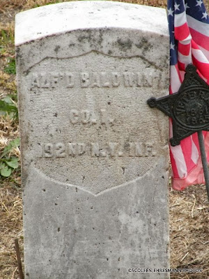
A headstone from an early area settler

The first recorded burial in the Bon Homme cemetery was a four year old child, Sophia M. Brown, the daughter of J. S. Brown who died on October 27, 1859. The cemetery had not been plotted yet and it was in 1862 that the land was donated by Benton Fraley for cemetery purposes. Other burials had taken place years before because in the process of digging graves other graves with no markings have been discovered.

In 1862 during the Indian threat, all families were ordered to move to the stockade which was built at Yankton. A small garrison of soldiers stayed in Bon Homme to protect it. During that time, fights occurred between the soldiers and an Irish boy, J. Delaney was killed in a duel by a soldier named W. W. Warford, who had been drinking. W. W. Warford was the son of Mrs. Rounds by her first husband. J. Delaney had then been regarded as the first official burial in the cemetery. His death was the reason for the story that Bon Homme was such a healthy place that they had to kill a man to start a cemetery.

In the spring of 1873, George Custer's 7th Cavalry was camped on the west side of Snatch Creek. Seven of his soldiers died of typhoid fever that spring and were buried on the banks of the creek. In 1893 by order of the Cemetery Association the remains of the soldiers were moved to the Bon Homme Cemetery. In 1922 a large homemade cement block tombstone was built by William Thomas Harrison to mark the burials. Six of the soldiers were unknown and the seventh one was named A. Hirsch." -from the history of Bon Homme County


 I found several headstones of soldiers from the Civil War. 


Their grave sites were marked with this star indicating a Civil War veteran.