Sunday, February 25, 2024

Kingman & Edward Fitzgerald Beale

It is 267 miles from Needles CA where we started driving Route 66 (when it was available) to our destination in Winslow AZ, our final Route 66 location. There were three towns on that stretch I thought were interesting and worthy of spending some time. You have seen the blog post on the ghost town of Two Guns, my first wish I had more time location. 

Kingman is the second town on my if I had more time list. Most of the historic stops in the town were located within 0.3 distance. The town is easy to drive, although very busy during the noon hour. 

the former railroad depot is now the Visitors Center and a museum


train car and 1928 steam engine in Railroad Park


and at the Visitors Center & Museum along the railroad tracks

In the hour or so we spent in Kingman, there were several trains that went through town.


This elevation notation was about 10 feet from the ground on the Visitors Center wall.


mileage from Kingman to other Route 66 major cities


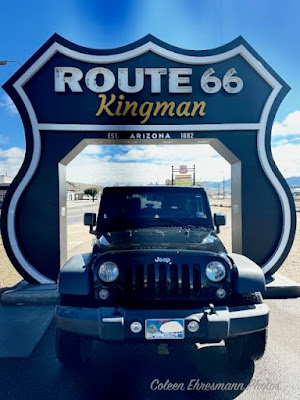
a drive through the Route 66 sign near the Visitors Center


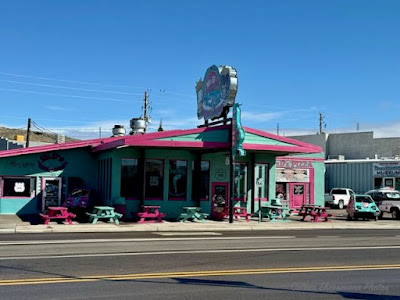
colorful Mr. D'z Route 66 Diner (still operating)


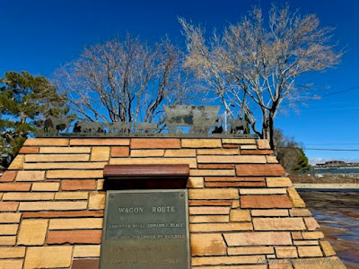
a triangular marker noting the history of the area
Kingman was founded in 1882 as a railroad siding


Edward Beale was commanded to build a Federal Wagon Road
across the 35th parallel passing through the area in 1857


His secondary orders were to test the feasibility of the use of camels 
as pack animals in the Southwestern desert. ~ Wikipedia


Beale has quite the military and government accomplishments
military officer (navy & army), frontiersman, and explorer
Superintendent of Indian Affairs in CA, surveyor, rancher,
Ambassador to Austria-Hungary 1876-1877
respected Washington DC host


But it is his story as Lt. of the Camel Corps that is so interesting. (Hi Jolly monument in Quartzite AZ)

Before Beale’s survey expedition (Federal Wagon Road), the first camels arrived from Africa in early 1857. In March, the Secretary of War ordered the formation of the 1st U.S. Army Camel Corps and appointed 35-year-old Lieutenant Edward Beale to command it.

Beale used 25 camels on his first survey expedition, loading them with supplies. The soldiers hated the animals for their ornery disposition, and Beale, at first, agreed. However, over time, he developed an appreciation for their ability, and by the time the expedition reached California, Beale believed in the camels’ worth. He utilized them again in another expedition in 1858-59 that extended the road from Fort SmithArkansas.  

Beale bought some of the camels once they were declared surplus. Hi Jolly was the camel driver/trainer for the survey expedition.


However, the camels scared the horses and mules, and the vast majority of soldiers refused to learn to ride them. Before long, critics claimed that the Camel Corps was a waste of money. Ultimately, the Army declined to continue the experiment with camels, and the herd was sold at auction or turned loose into the desert. In the meantime, Beale completed what became known as the Beale Wagon Road, a popular immigrant trail during the 1860s-70s.  ~ Legends of America


Of the road, Beale would later write:

“It is the shortest route from our western frontier by 300 miles, being nearly directly west. It is the most level, our wagons only double-teaming once in the entire distance, and that at a short hill and over a surface, heretofore unbroken by wheels or trail on any kind. It is well-watered! Our greatest distance without water at any time being twenty miles … It crosses the great desert at its narrowest point.”

Beale's Wagon Road became part of U.S. Route 66 and later Interstate 40. Remnants of the wagon road can still be seen in White Cliffs Canyon in Kingman.


Deceiving Advertising: the map is actually murals painted on the walls of the motel. Another frustrating bit at this location was the item we were looking for had been removed from the motel over a year ago. The current motel staff made two phone calls to previous staff/owners to get the answer for us, as we need it to complete the Adventure Lab and earn the virtual post card souvenir.


another of the 14 completed Route 66 in AZ


Saturday, February 24, 2024

Two Guns

 Two Guns (an AZ ghost town) has been on my Wanna See list for sometime. I don't know if I would say Bucket List, but a Wanna See List. I had first heard of Two Guns from other AZ geocachers I know but other than a cave, I knew very little about Two Guns. So when our very last Arizona Route 66 Adventure Lab was taking us to Two Guns, I was quite excited and more than a little uninformed!

Two Guns, originally known as Canyon Lodge, started out as a modest trading post at the beginning of the 19th century, run by a couple of homesteaders by the names of Mr. and Mrs. Daniel B. Oldfield. 

By the early 1920s the road through town, known as the National Trail Highway, became the preferred route across Diablo Canyon. When Earle and Louise Cundiff blew into town, they brought 320 acres of the land, making Canyon Lodge a busy stop for travelers. By the late ’20s, what was once the National Trail Highway was blossoming into the famed Route 66, and the once-isolated trading post was evolving into a bustling stop for incoming drivers needing gas, food, and oil.

entrance to the zoo*

This quickly escalating prosperity caught the attention of a man named Harry Miller. A well-educated veteran of the Spanish-American War and an ostentatious publicist, Miller was an eccentric man who claimed to be full-blooded Apache and was known for his garish and unpleasant demeanor. Wanting a piece of the action, Harry “Two Guns” Miller allegedly struck a deal with the Cundiffs to lease a business site for ten years.

the back side of the zoo entrance

Under Miller’s watch, the trading post was renamed Two Guns and turned into a full-blown tourist trap. He grew out his hair and braided it, taking on a persona by the name of Chief Crazy Thunder. He started a zoo with chicken-wire cages that held mountain lions and other native Arizona animals.

remains of the large animal cages


Apache Death Cave with ramp leading down the canyon wall
brave people can still enter the cave today and explore

Two Guns was the site of a mass murder of Apaches by their Navajo enemies in 1878. Some Apaches had hidden in a cave at Two Guns to avoid detection, but were discovered by the Navajos, who lit sagebrush fires at the cave's exit and shot any Apaches trying to escape. The fire asphyxiated 42 Apaches, after which they were stripped of their valuables. The murder site is referred to as the "death cave". ~ Wikipedia

back to Harry Miller...

Miller started tours down into a canyon cave now called Apache Death Cave, where 42 Apache men met their death in battle. The story of the cave was interesting in its own right, but Miller believed that the tale needed something more. He cleaned up the remaining bones he found in the cave, built fake ruins, and repurposed the tomb into a “cave dwelling.” In a macabre commercial stroke of genius, he saved the skulls of the ill-fated Apache and sold them as souvenirs. In order to make the cave a bit more tourist-friendly, he also strung up some electric lighting, threw in a soda stand, and renamed the death cave the “Mystery Cave.”


rock remains of the house Miller built over the cave and the rest of the canyon looking west

The terms and broad wording of Miller’s ten-year lease had always been a source of tension between him and Earl Cundiff, and that tension finally came to a head on March 3, 1926. During a heated dispute over the lease, Miller shot Cundiff in cold blood. For unknown reasons, Miller was acquitted at the trial. While Miller didn’t go to prison, he suffered in other ways. Shortly after his trial, Miller was mauled by a mountain lion on two separate occasions. He also was bitten by a poisonous Gila monster, which led to an illness and a completely swollen arm.

looking east from the bridge


first bridge built across the canyon in 1915
this bridge built in 1938
Miller's zoo and most of the original tourist attractions were erected on the north side of the canyon. Many ruins and standing buildings are on the south side of the bridge.

In 1929, a huge fire would gut the trading post at Two Guns, and when the widow Cundiff tried to prove her claim on the homestead land, Miller protested, claiming that the land was his because he was there before them, which was a bold-faced lie. After $15,000 worth of court actions later, Cundiff managed to keep ownership of the land – Miller would leave soon after. Even without Miller, Two Guns and its inhabitants continued to suffer. Route 66 was rerouted to the opposite canyon, taking its travelers and their money with it. Louise Cundiff and her new husband, Phillip Hersch, had to rebuild everything in Two Guns, including the zoo, on the opposite canyon just to keep the town going. Two Guns was finally sold in the 1950s, and doomed to be leased and abandoned numerous times until 1960.

more building remains*


remains of the garage - other building remains just south of the garage behind fencing

In 1960 a man named Dreher revitalized the area with a restaurant, gift shop, gas station, and even another shot at a zoo. He created tourist trails to the cave, and began exploring the possibilities of touring the cavern where all of those Apache warriors Miller claimed to be descended from lost their lives. 

With Interstate 40 on its way to completion, Two Guns would have its own dedicated exit ramp, which meant tourists would once again be passing through the town. All was going splendidly – until a huge inferno swallowed up the entire place in 1971. 

That was be the last time Two Guns would ever be inhabited. 

Two Guns is now considered an abandoned ghost town. The ruins of the zoo and the gutted gas station still stand, and you can still visit the cave. In 2011, Russell Crowe purchased Two Guns to film a Westworld remake.

There are two water towers remaining. I bet there were close to 100 stone buildings in ruins on the two sides of the canyon. It was getting close to sundown when we were there. I would have liked to have more time to explore and take photos. Oh well... There was a KOA campground with a swimming pool, but the building is demolished. Two Guns must have been quite the place in its Glory Days, but like so many of the places we have seen in northern AZ while traveling to and through the hamlets and tourist attractions popular before the days of Interstate highways, they have all seen better days.

I visited many sources to be better informed about Two Guns, but the information I have copied is pretty close to every source I explored. If you want to know more about Harry Miller and his exploitations, just Google Two Guns.

Native artifacts found at Two Guns have been dated to between 1050 and 1600.

not my photos

Italicised text from https://www.atlasobscura.com/places/two-guns, except where noted from Wikipedia


Sunday, February 18, 2024

Valentine's Day 2024

Yes, I know. I'm late. Many of you know we went geocaching with friends Jon & Sherry on Valentine's Day as Sherry is so good and speedy about posting photos on Facebook. So you have seen some of the photos. My post will show some of the things - usual and unusual - one might see while geocaching in the desert in Apache Junction & Mesa.

We saw this oldie while driving to ground zero.


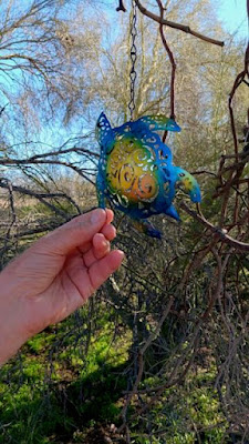
We were on the search for turtles hidden by a geocacher named Tic-Toc Turtle. 


He has something like 70 some TTT hidden geocaches. We are amazed at the variety turtles he has collected and hidden. They are all different.


Some were hidden hanging in trees. Some were hidden on the ground under rocks or branches. Or like this little guy, some were hidden in dead cactus or tree branches.


The turtles were various sizes, from a quarter to the size of a large tortilla. Most were very easy to find, which is always nice when walking in the desert.


It is not unusual to see horses in the area where we were geocaching. I don't know if this rider was done or getting started.


two riders


This horse was sporting his winter coat. He also had very hairy legs. The rider was from Canada. The ladies had two dogs with them.


Five wooden cross grave markers and five rock lined graves but no disturbed soil????


two towers had nests in the supports


large nests, maybe hawks or owls?


a skull about 10 inches long


more desert trail riders
Horses were the only animals we saw. No geckos were scampering about. We have been told if we see geckos, we might also see snakes. I guess it has just been too cold for the reptiles. That's okay by me!


One of the horses at a Horse Boarding across the road from the desert area we were in for geocaching.


We were dressed appropriately for the day.


Geocaching hearts for our efforts on a perfect temperature day for walking in the desert.


Monday, February 12, 2024

The Final Post from Yuma

 Saturday morning started at Martha's Gardens, a date farm in Yuma, where geocachers gathered to get a passport listing 20 locations in and around Yuma where we needed to find an object or geocache to get a number to complete the passport. By 8:30 vehicles were heading out like race horses leaving the gate. We've done this so many times (maybe 7 times in 8 years) that it is getting harder to find interesting places we have not seen before. We completed the race and turned in our passports about 1:00 and rewarded ourselves with lunch at Lutz.


Then it was off to work on a couple more Adventure Labs we had started on Friday. We attended one more event on Saturday evening hosted by geocachers from Washington state.


The following photos are of locations and geocaches we found while driving around the Yuma area.

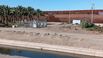
within a couple hundred feet of the wall and the Mexican border


African daisies in a yard out in the country


trimmed trees on Main Street in Somerton


One of two very tough geocache hides we found, thanks to some help from other geocachers. This was a rail spike in a no longer used railroad bed. 


The geocache is a bit shinier and a different shape than the other rail spikes. When you have no idea what you are looking for the task is much harder. 


 one of ten murals we found during our weekend adventure


this cache owner used a VCR tape to create the geocache log 
winding the log between the two spools
another clever idea


a mural on the campus of Arizona Western College


completed on Monday on our way out of town


also completed on Monday 


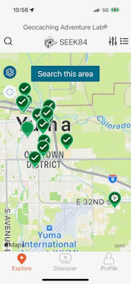
Each of the green circles is an Adventure Lab in Yuma, most of them having 10 geocache locations. There are two we have not completed, the two without checkmarks in the center. I found 18 on the map that we have completed and four we have yet to do. We will not run out of geocaches in Yuma! So until next year...