Tuesday, April 21, 2015

Traveling & Caching Through Colorado

Our first caching stop in Colorado was another Virtual Cache titled The Ludlow Massacre.


On April 20, 1914 nineteen innocent men, women and children were killed in the Ludlow Massacre. Coal miners in Colorado and other western states had been trying to join the UMWA, for many years, but were bitterly opposed by the coal operators, led by the Colorado Fuel and iron Company, owned by John D. Rockefeller, Jr.


"Upon striking, the miners and their families had been evicted from their company-owned houses and had set up a tent colony on public property. The massacre occurred in a carefully planned attack on the tent city by Colorado militiamen, coal company guards, and thugs hired as private detectives and strike breakers.


"They shot and burned to death 18 striking miners and their families and one company man. Four women and 11 small children died holding each other under burning tents.  Later investigations revealed that kerosine had intentionally been poured on the tents to set them ablaze. The miners had dug foxholes so the some and children could avoid the bullets that randomly were shot through the tent colony by company thugs. the women and children were found huddled together at the bottoms of their tents."


The Ludlow Massacre was the 'beginning' of the conflict called "The Colorado Coalfield War" which ended on December 10, 1914 when the UMWA finally ran out of money and called off the strike. The Colorado Coalfield War  had a death toll of about 75 people before president Woodrow Wilson sent Federal troops to disarm both sides.


The Ludlow strike and the Colorado Coalfield War had a lasting impact on conditions at Colorado mines and on labor relations nationally. John D Rockefeller, Jr. worked with the Canadian Prime Minister to develop reforms for the mines and the towns, which included paved roads and recreational facilities, as well as worker representation on committees dealing with working conditions, safety, health, and recreation. - Wikipedia


"A monument erected by the UMWA stands today in Ludlow, Colorado in remembrance of the brave and innocent souls who died for freedom and human dignity." -from United Mine Workers of America (all quoted sections are from this web site)

*Ludlow is now a ghost town, but the Ludlow Tent Colony Site was declared a U.S. National Historic Landmark.

*George S. McGovern, Senator from South Dakota, wrote his doctorate dissertation and eventually a 
book The Great Coalfield War about the Colorado Coalfield conflict and war.


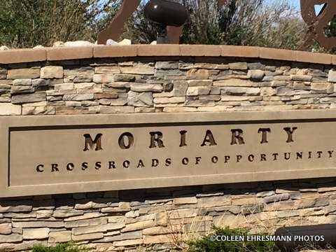
We spent the night in Pueblo completing a few more caches, and then headed to Colorado Springs on Saturday morning so we could attend a Breakfast Meet & Greet geocaching event; our first CO event.
(I wasn't going to miss a second one!)


snow covered mountains and cloudy skies
greeted us in Colorado Springs


this front met us as we came back into town after caching
northeast of Colorado Springs
some sleet, some rain, some snow throughout the day
no measurable amounts


a virtual cache at the old train depot


Hubby ate at a restaurant in the depot when he was activated
for Desert Storm and awaited deployment at Fort Carson
he said they served excellent spaghetti
the restaurant closed a year ago


and a virtual at a log house
in downtown Colorado Springs


I was surprised at the number of homeless people in the areas of the last two cache sites. They were hanging out in the parks. It was an alarming number, mostly men.

Not only does geocaching take us to places we might not visit if it wasn't for caching, but we often learn things we never knew, like the Ludlow Massacre. Reading the signs at the Historic site made an impact, but doing the research for this post made even more of an impact. 

Our cache collection after Colorado Springs was rather boring. We found several more Welcome to... caches in Nebraska and South Dakota. We were on a time frame so there wasn't time for any earth caches or virtuals. It was time to take the shortest route possible and get home.


Sunday, April 19, 2015

Traveling & Caching Through New Mexico

Since we are one day from arriving back home, I best get caught up with the trip. Tonight is the first night I feel like I have the time and energy to deal with the blog. Travel has been good without incidents like weather or accidents. This trip home was to include some new roads (this IS the 10th trip to & from) and some interesting and different geocaches, basically virtual geocaches. "A Virtual Cache is about discovering a location rather than a container. -you may be required to answer a question about the location, take a picture, complete a task, etc." Usually Virtual Caches are located at a location of some historical significance. Such was the case on this trip.

We spent our first night in Albuquerque. Originally, we had planned to stay in Grants, but because we got started earlier than we thought, we made the change. That was good and bad: good because we ended the day 100 miles closer to our second day destination, bad because we did not plan for any geocaching in Albuquerque. We missed an event that evening a half mile from the hotel. (Bummer, as we are trying to reach 100 events. We are close...)

I was able to use the geocaching app on my iPhone to find a nearby Virtual Cache, "Our Lady of the Tree".

as required, we had our pictures taken with 
Our Lady in the Tree


in Old Town Albuquerque


San Felipe De Neri
oldest church in Albuquerque
providing services for 309 years


Easter display in the front courtyard


archway between church and church residence


a beautiful, well-preserved structure

(This is why we LOVE Virtual Caches)


Our next stop was Moriarty, NM to collect a traditional cache titled "Welcome to Moriarty." I am also collecting 100 Welcome to... caches. The cache was at the intersection of two highways.


I am unsure of the significance of the surveyor statue


cowboys and ranching area


We took a good road with very little traffic that passed by Los Montoyas, a spot on the road, not even a dot on the map. 


some fresh graves
notice the bench to the right


a headstone


 well cared for graves
very desolate country in northeast NM

The higher we climbed in elevation, the more cloudy the sky became, and the cooler the temperatures. Our last stop was the Visitor's Center in Raton NM before crossing the Raton Pass into Colorado where we spent the next two nights. 


Thursday, April 16, 2015

Cactus Flowers at the Arizonian

The Arizonian is an RV park several miles to the east of our winter RV resort. Friends, who used to stay in our resort, now spend their winters at the Arizonian. Brenda lets me know when the saguaro and other cacti are blooming. On March 30th I headed east because the Argentine Giant Cactus was blooming. Brenda's photos were amazing and I did not want to miss the magnificent color. There were so many cacti varieties in bloom and an interesting tree, too.

I do not know the name of most of these, so just enjoy the colors of spring in the desert!


Bottle Brush


tree? bush? Bottle Brush


The Argentine Giant 


pink and orange and purple


Ocotillo


fruit of last year's flower on the prickly pear


from another location
but appropriate because...


Gamber Quail


We said goodbye to the desert this morning (Thursday) as we have begun our journey back to SD for the summer.


The End of Her Visit

OFD (our favorite [& only] daughter) had one more request during her recent visit. Since it involved food and one of our favorite eating places, her request was honored, gladly.


It was a fun 5 days, not packed to the gills, but with a variety of activities to satisfy all three of us. 


We noticed the interesting cloud formations. on our way home. They looked like feathers of an ostrich or emu.


We are now on the countdown of our winter stay. There will be a couple more AZ posts after we have left our winter home. We plan to do some geocaching on the way back to SD, by way of CO this year.  geocaching may or may not we blog worthy. Time will tell.

Wednesday, April 15, 2015

Part 2 of Road Trip with OFD

Yesterday's post was of the desert part of the Desert to Tall Pines Highway from Roosevelt Lake to Young AZ. This post continues with the rest of that highway and then some.

Ponderosa Pine
you can almost smell the pine trees

some deciduous trees with their fall colors in April


The elevation was over 7000' at one point on this road. We ate our lunch at this stop. Hubby found another cache. 

I found a low growing, large flower daisy


The paved road ended. There was more traffic on the road which meant we were closer to a community. We followed this trailer for a number of miles. We were able to pass the outfit eventually and saw 4 angus steers in the compartment in front of the horses.

interesting bark on the tree

our first view of Pleasant Valley & our destination

interesting history

growing along the road near another geocache

a wild tiger lily

the Young Cemetery


We stopped because there was a geocache somewhere in the cemetery. We did find it and learned more about the feud between two ranchers in Pleasant Valley. This is ranch country. The town was renamed Young after the first postmistress when it was realized a Pleasant Valley AZ already existed.


More information about the feud between the cattle-herding Graham and sheep-herding Tewksbury families between 1887-1892 can be found at this site. It is an interesting story. AZ Pleasant Valley War

white iris near some headstones


OFD needed a restroom by this time. (No trees or bushes for her!) We stopped at the community gas station where I noticed these California poppies going on the hillside. The flower is a little larger than the Mexican poppy. The color is more orange and the plant has more foliage. I have a California poppy in one of my flower beds at home. It bloomed all summer long.


What is she smelling?

LILACS! a very small lilac bush at the gas station

The population of Young is between 500-600 residents. The gas station attendant told us the population swells to over 800 in the summer as Valley residents head to higher elevations and cooler temperatures. The town had a small grocery store, the one gas station, two eating establishments (not open on Monday or Tuesday) a couple of churches, a museum near the cemetery, a post office, a farm/ranch supply business, a community center and maybe a few others. We figured folks drove 50 to almost 70 miles for any other services or groceries. We had just traveled over the best road, but we did not know that at the time. We could either go back the way we came or head north and meet up with Highway 260 going to Payson. Hubby asked the gas station attendant if the road north was paved. She said yes. Well, it was for the first 4 miles and the last 4 miles. The other 15 miles was the worst wash-board road I have traveled since leaving the farm. But it was scenic!


Two forest fires burned the Tonto National Forest north of Young. The Rodeo-Chediski fire burned 144,000 acres in 2001 and the Poco Fire in 2012 burned 11,950 right outside the city limits. 

a stand of birch trees along Forest Road 512

back on paved road north of Payson on the Mogollon Rim
looking at 4 or 5 mountain ranges

Hans did not lie. It was a very scenic road. OFD was not disappointed either. She took lots of photos and traveled from the desert to the mountains...in Lil' Red. Hubby was pleased because we added 8 caches to the total. (There are maybe 20 more along the road for another year.) And I was thrilled to get photos of flowers and another crested saguaro. We traveled about 250 miles on that loop. Next time we'll come back on the Desert to Tall Pines Highway. Thanks Hans for the great recommendation.