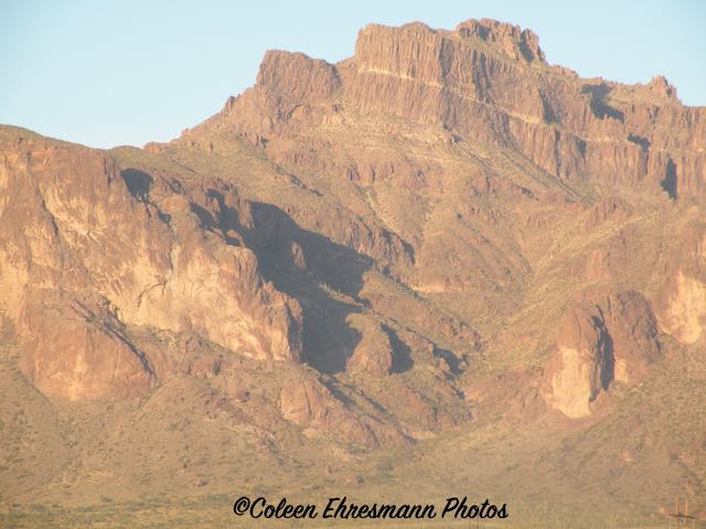
As I mentioned in the previous post, we are currently camping and caching in the Gila Bend area of AZ. Geocaching is bringing us to some interesting locations on this adventure. We have been to this area a number of years ago to check out the Painted Rocks and petroglyphs and the site of the Oatman Massacre. Lava rocks can be seen from Interstate 8. This excursion took us to a couple of new locations with an interesting story.

Desert Springs Tilapia Farm
According to their website, Desert Springs Tilapia is never frozen, always fresh to market and raised with natural feeds, pure water and sunshine.
With its pristine and unpolluted natural water resources, the Hyder Valley fresh spring aquifer provides a warm, salty water supply perfectly suited for the development of high quality Tilapia. Our deep wells produce pure, clean water with 4ppm salinity at a constant 85° F (29.5° C), the ideal combination for Tilapia aquaculture.
Juvenile Tilapia are raised to maturity in custom-built, plastic-lined ponds and raceways. Fresh spring water is continuously circulated to provide maximum oxygen levels, and a clean, disease/contaminant-free environment. Our self-cleaning system removes all organic material released by the growing fish.
Desert Springs Tilapia has made a solid commitment to environmentally friendly policies which protect our pristine resources. All water circulated through our ponds and raceways becomes rich in nutrients, which act as a natural fertilizer. Water is reused in the agricultural production of alfalfa, Bermuda grass hay, barley, oats and olive trees. Desert Springs Tilapia is committed to recycle, reuse and restore our resources.
I did not expect to see a fish farm in the desert. There were many plastic-lined tanks at two locations along the highway. Beyond a dike of sorts, I could see more water pumping, assuming there were tanks in that area also. The farm had about a half dozen homes which I assumed was housing for the workers, as there was no community nearby.
* * * * *
Spanish missionary, Father Jacob Sedelmayer named Santa Maria del Agua Caliente in 1744. Agua Caliente means "hot water" in Spanish.
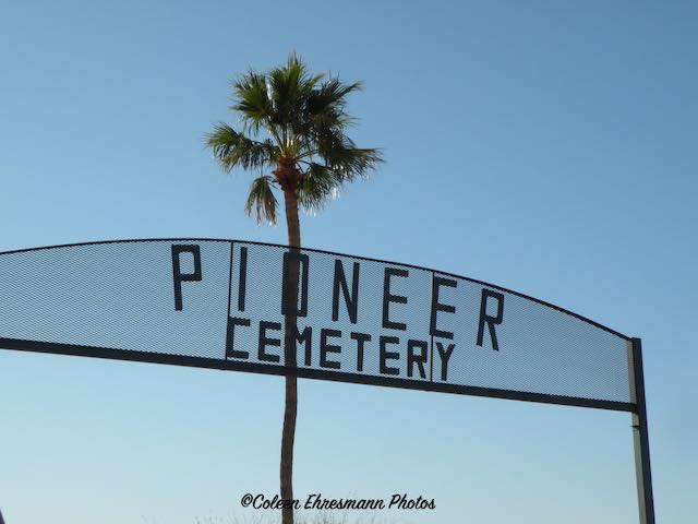
Seeing the sign for the cemetery I realized there was a community Agua Caliente. The earliest resident was laid to rest in 1896, according to a headstone. (There may be earlier burials.)
This was the area for more recent interments, including some military servicemen.
And the area of older interments. One site reported 123 burials total including 78 unmarked graves.
* * * * *
These stone ruins are of several buildings, including a home, a store, a saloon and outbuildings using stones from the area. There was also at least one adobe ruin at this location. The stone buildings were built to support the visitors at the hotel.
Agua Caliente Hotel (north side)
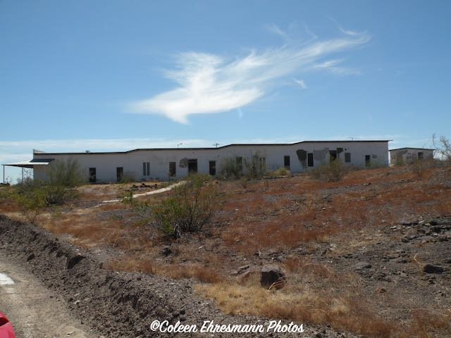
King S. Woolsey started the Agua Caliente Ranch at this location in 1873. King was an American pioneer rancher, Indian-fighter, prospector and politician. Because of the popularity of the hot springs he built a 22 room hotel in 1897. A pond in a field collected the hot springs water for use by the resort's visitors and was very popular. The Tonto Apaches used the hot springs for health reasons before the area was settled by the missionaries and the ranchers.
A swimming pool was built by the army to be used by the troops stationed at nearby Camp Horn. Camp Horn was built to train troops for action in the desert of North Africa during WWII. Most likely it was the officers who frequented the resort and used the swimming pool. (I could see evidence of the swimming pool across the road from the hotel.)
south side of the hotel
The hot springs have dried up, probably due to the over-irrigation by area farmers and ranchers. The hotel is closed and posted as private property. There is a caretaker on the property. The buildings were in very good condition; no broken windows and doors intact. Interesting to note the highway went right in front like less than 5 feet from the front steps and porch of the hotel.
A couple miles to the west is what is left of the community of Agua Caliente, or at least I think that once was a small village. There are no businesses or evidence of any, but maybe 20 residences clustered on the north and south side of the paved road. It became a ghost town once the hot springs dried up and when Camp Horn was no longer used. Also contributing to its demise was the building of Highway 85 and Interstate 8 which bypassed the community.
an unoccupied stone house in the area
that is a lot of rock hauling!
* * * * *
a road side memorial in the lava field
ridges of lava
I have been intrigued by the lava rocks since I first saw them in 2013. This is part of the Sentinel Plains lava field and is the result of 2 dozen volcanic centers which were active some 3.3 million years to 1.3 million years ago. The Sentinel Plains covers about 281 square miles. The volcanoes provided some very rich farmland along the Gila River.