Friday, August 13, 2021

East Glacier National Park

Once we realized (rather late, I might add) that we would not be able to just drive into Glacier National Park or just hop on a shuttle bus, we got busy trying to get tickets. That was nearly impossible a month prior to our visit. We were able to book an all day tour with Sun Tour, a company owned and operated by the native people, the Blackfeet. There is one other tour bus option and I will comment on it later. 

Glacier National Park and many of the others (like the Smokey Mountain Park of our June trip) are so crowded with visitors, the only way to manage the number of people is through tickets. We did not understand to get on the free shuttle you had to buy a $2.00 pass for a specific day and time long before you wanted to ride the hop-on-hop-off vans. After several phone calls to the campground and some very competent and helpful staff people, we finally got it...the Tour and the Ticket-to-Ride.

So this post is from the Sun Tour. We drove south to East Glacier Park Village to catch our tour van.

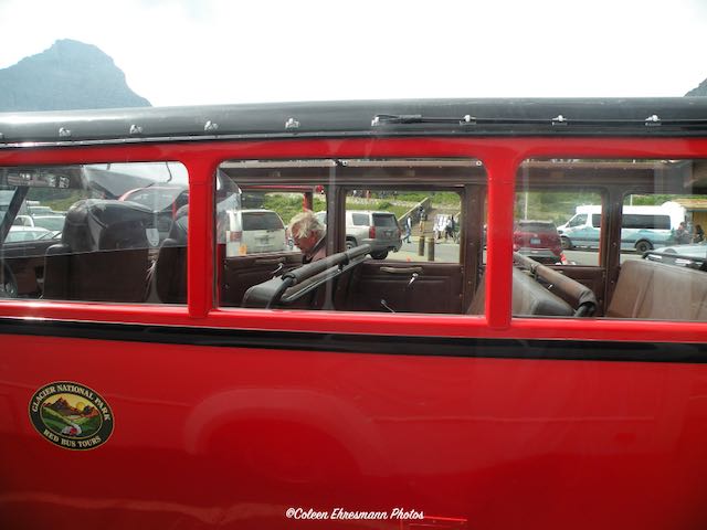
We knew this would NOT be our tour ride. I think it is publicity for the lodge and the Glacier National Park Red Bus Tours, which could be booked (in advance) at the lodge.


Dan from the Blackfeet people was our driver. He is to the right of the van. There were 20 of us on the tour.


The Red Buses have an open top and bench seats. We did not see any people wearing their masks when we met a Red Bus. Everyone on our tour did wear their masks. It was required, as it was in all buildings in the park. (Of course, there were some who did not wear masks.) Our van was air conditioned and equipped with seat belts and a roof.


The lodge at East Glacier Village is known as The Big Tree Lodge. 


And this is why. 
Glacier Park Lodge is the original lodge constructed by the Great Northern Railway in 1913 and for the last 100 years, it has been the first stop for visitors traveling to Glacier by Amtrak train. 

The highlight of Glacier Park Lodge is the huge Douglas fir pillars that are over 40 feet high and 40 inches in diameter that form the supports in the distinguished lobby and the lodge's decor is reflective of the culture of the surrounding Native American communities.

It is impressive. The Amtrak station was across the street and several (I think 6 or 8) of our tour companions had come to Glacier via Amtrak.


Our driver pointed out this beaver dam along the highway back to Glacier National Park. (We were 40 miles away from the main entrance.)


The flags at the Visitor's Center. The Canadian flag, the Blackfoot Nation flag, and the US flag. The border to Canada is open to US travelers showing proof of vaccinations and 72 hour negative covid test. It opened on August 9th. The border is not open to Canadian visitors until August 14th.


A tour boat on Saint Mary Lake. There were white caps on the lake when we passed by in the morning. The day of our tour was very windy and quite chilly, but better than the day before. A front was moving through so once we got into the mountains the views were not very good, for photos.


Goose Island in Lake Saint Mary. Notice the clouds and view of the snow on the mountains in the distance.


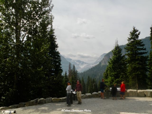
Our view of Jackson Glacier. My map says there are 25 glaciers on the US side of Waterton-Glacier International Peace Park. This is the only one pointed out to us by Dan.


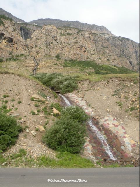
A waterfall; one of the longest we saw on our East Glacier tour. We did stop here for a photo opportunity because there happened to be parking space available. There were places Dan could not stop because of all the vehicles.


Another view of Jackson Glacier. The sky was also affected by the smoke from fires in Montana and Canada. And probably other states, too. Between the weather front and the smoke, it was a disappointing photo day.


Another waterfall


And another one. I will say we did see lots of waterfalls. And no, I did not get photos os all of them.


This is considered the midpoint in the park, although by miles it is not. Logan Pass has a bookstore/gift shop, bathrooms, shuttle exchange, big (packed) parking lot as it is a starting point for many popular hikes. Notice our sweatshirts and jeans. We were happy to have dressed that way. (Dan did say it was in the 90s for temperatures last week.)

Going-to-the-Sun Road is the only road going east to west/west to east in the park. I did not realize our all day tour ended at Logan Pass, just like the half-day tours. After Logan Pass we went back to St. Mary/East Glacier for lunch at the lodge and then the ride back to East Glacier Village where we started. WHAT???? I don't get to West Glacier on the tour? So what are we doing for the next 3 hours????

Dan took us back on Scenic Highway 49, a shorter distance than what we traveled on our morning trip because we had to stop in Browning to pick up passengers. We had also driven Scenic Highway 49 (Looking Glass Road) at 7 AM that morning and there were parts of that road that made me glad I had not eaten any breakfast. But with Dan in charge of the driving I was more relaxed and able to take in the views.


prairie before the mountains


A view of Lower Two Medicine Lake created from Two Medicine River when it was damed for hydro power. (There is an Upper Two Medicine Lake that is a natural lake.) Also notice fewer clouds and blue sky as we were south of the morning tour area which had begun to get cloudier by when we left mid-afternoon.

After leaving the bus tour at the lodge, we did some exploring of East Glacier Village on our own. We were in search of a geocache.


We found the geocache on one of the horse's legs. These metal sculptures are very interesting. Some of the parts are from cars. There will be a close-up in another blog post. We have seen 3 of these sculptures on the east side of Glacier Park.

Once we found our geocache in the village we drove to the Two Medicine Lake entrance of the national park. No waiting line. Just show our pass and drive. This sign was our greeting.


This waterfall was our destination. It was a short .20 mile walk along a nature trail. We could hear the falls before we saw it. It looks like it just comes out of the rock wall. 


This is a shortened version of the real person, Running Eagle, and her importance to the Blackfeet people. The falls are named in her honor.


These are thimble berries, or wild raspberries. They are beginning to ripen and are a favorite of the black bears in the park. When we arrived at the parking lot for our walk to the falls, two park rangers were there. They told us a sighting of a black bear had been reported, but they did not find anything. There were quite a few people around, so we decided to continue to the falls. Hubby had his hiking stick...just in case. We did not see any bears in the Running Eagle Falls area. BUT...


we did see one along the road leading out of the Two Medicine park entrance. It was about 15 feet from the side of the road. Hubby stopped, rolled down his window and I took photos while the bear collected thimble berries. he did not bother to look at us and only moved on when Hubby honked the horn several times.

I had seen a bear along the road from our campground to St. Mary that morning, about 6:45 AM. But I had not had enough coffee. Hubby did not see the bear. In fact, I don't think he believed me when I said, "There's a bear!" We did not stop because we did not know how long it would take to drive to meet the tour bus. In the mountains the number of miles do NOT equal number of minutes. The sighting near Lower Two Medicine made up for the missed photo opportunity that morning.


And finally, an Osprey nest. When we passed the nest earlier in the day we could see a couple of heads (adult and baby) peeking out. No heads were sighted for this photo.


I finally get to West Glacier on the Ticket-to-Ride shuttle. That is the next blog post.
 

Tuesday, August 10, 2021

The Falls of Great Falls

According to Wikipedia: Great Falls is named for a series of five waterfalls located on the Missouri River north and east of the city. The Lewis and Clark Expedition of 1805–1806 was forced to portage around a 10-mile (16 km) stretch of the river in order to bypass the falls; the company spent 31 days in the area, performing arduous labor to make the portage. Three of the waterfalls, known as Black Eagle, Rainbow and the Great Falls (or the Big Falls), are among the sites of five hydroelectric dams in the area, giving the city its moniker, “The Electric City”.


So thanks to geocaching, we went in search of the falls. The first stop was Black Eagle.


The falls were there before the hydro plant. The Black Eagle Falls are similar but much smaller than the Sioux Falls falls. See this blog post for a comparison.


The Missouri River contained within the granite walls. 


Farther east was another hydro plant. This was Rainbow Falls.


No sun so no rainbow. We did not see Great Falls and saw only two of the five hydro electric power plants.


Then we went to a spot about halfway between the two hydro plants to this state park.


More water falls. These are a result of Giant Springs, also found and named by Lewis and Clark. However, the natives had first rights to finding and naming.


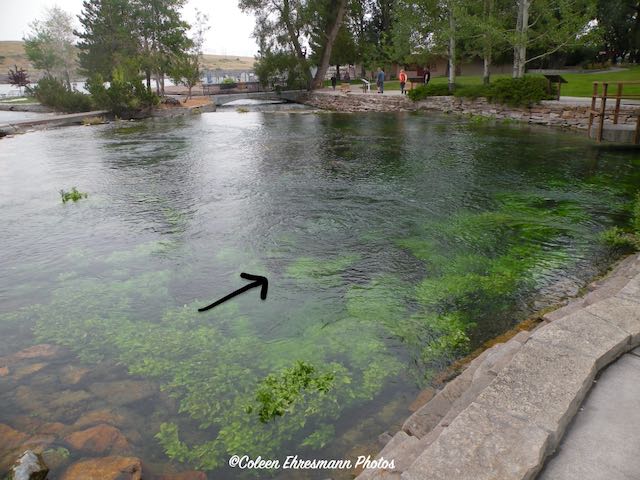
This was the springs bubbling in the pond area. 


And my arrow pointing to the springs and the size of the pool of water. What makes this so unique is the springs creates the shortest river in the world! Confirmed by the Guinness Book of World Records. The water temperature is a constant 54ยบ. The river is 210' long and empties into the Missouri, which is to the left of the 'rock wall.'  Interesting to note: the shortest river flows into the longest.


And a follow-up to the wheat story of yesterday. On our drive to the falls we saw grain elevators, HUGE grain elevators. They were on the south side of the river and we were driving on the north bank.

Sorry about the blurry photo, but Hubby says, hurry up and take the photo. I did. Columbia Falls elevator and...


General Mills. There was a third one, but it was too far away. Now we know where the grain is trucked and sold.


Monday, August 9, 2021

Wheat Country Montana

 On our drives through farmland in Montana, the main crop seems to be wheat, and lots of it. Corn and soybeans are prevalent in our part of the country; rarely do we see fields of small grain.

One of the reasons for our stay in the Great Falls area was to complete a geoart. We were about 30 miles north and west of Great Falls the day we collected the 79 puzzle caches.


We traveled on gravel roads between fields, pastures and hay land. There was very little traffic; no harvesting equipment or grain trucks to share the road.


The cache containers were preform tubes under a rock or two, next to a pole or fence post. Easy finds. Most of the ditches were not steep or wide. No snakes...just grasshoppers.


Some fields had not been harvested yet.


Some were done. Some had not been planted at all.


This field had been swathed. Those are some big, heavy swathes.


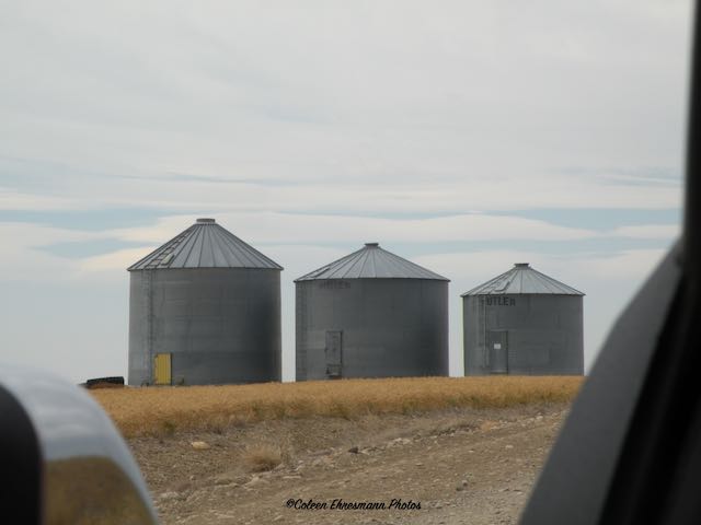
One thing I noticed was the lack of huge or numerous grain bins in the fields or on the few farms we passed. Often it was like this photo, three bins. So we think the wheat must be trucked to community elevators. The fields are HUGE and would fill the bins easily.


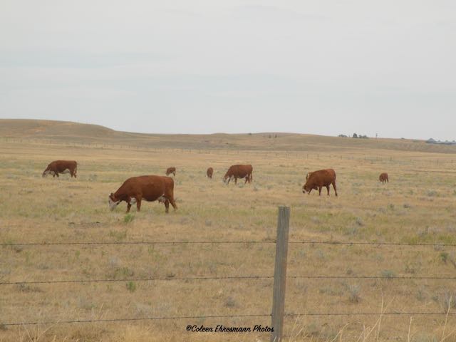
We saw some cows, but not many considering the size of the pastures and the amount of pasture land. But it is very dry in this area. No irrigation for the fields.


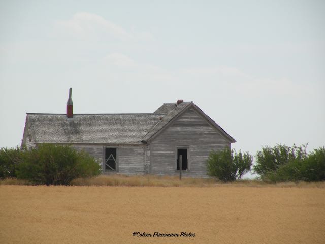
An abandoned farm house looking lonely and weathered.


And a field that is NOT wheat, but beans or peas. The house in the above photo was in this field. 


Hubby picked one pod. The kernel looks like a chick pea.


Pronghorn antelope. There were two standing in the field looking at us. They weren't there when we drove west, but were when we returned to the main road.


Then we realized there were three more resting in the field. They blended in so well. (The third one is to the right, just out of the camera shot.)

We also saw a coyote, but it was moving right along and I could not get the camera out and focused fast enough. 


There were a large number of horses in a number of different fenced areas on a farm. There were different breeds of horses. Two had the look and size of Percherons. Some had very long ears like mules or donkeys.


Without attracting too much attention (there was a gentleman working in the yard of the farm) I took photos. This was the only donkey we saw. But it was hard to tell if there were more among the about 40 we did see.


Not much grass for any of them to eat. The farmer did have hay racks in each of the fenced areas.


We stopped at an approach to switch drivers on the way back to Great Falls. We noticed a pile of spilled grain on the highway. The grain was not there three hours earlier. It looks like corn.


But it isn't. Peas? Lentils? My brother has planted field peas, but he cuts them green and chops them for cattle feed. 


This photo shows we were traveling on straight country roads to find the 79 puzzle caches. The truck was VERY dirty/dusty when we completed the geoart. It went through a car wash as soon as we got back to town.


This is what we accomplished on Saturday on our drive in the country. Eighty miles. Seventy-nine geocaches. Great country scenery. Wildlife and farm animals. Farming country. Sunshine and blue sky. It was a good day for these two farm kids!


Sunday, August 8, 2021

Geocaching in and Around Three Forks

 We had some time and opportunity to explore the area around Three Forks during our two day stay. Here are some of the more interesting things we saw and geocache locations. 


We stopped at Logan for a geocache. Interesting how many businesses were here prior to the 1919 fire. It grew because of the railroad, like many other small towns in other states. Ten freight trains and six passenger trains stopped daily. Amtrak had service to Logan until 1979. 


This is Logan today. There were a few inhabited homes. The business seemed to be the grain elevator. We think there was an eating place, whether a cafe or bar called Magic Land, but we did not see another business on our drive throughs.


This church hasn't seen parishioners or a coat of paint in several years!


Read about Colter's Run from this Wikipedia site: John Colter

John Colter and John Potts were two of the Lewis and Clark Expedition Party. Both men returned to the area after the Lewis and Clark Expedition was completed. Both men have an interesting history.

Three Forks keeps the story alive with a Colter's Run each year. 
The 43rd John Colter Run is on Saturday, September 18, 2021. Join us at Missouri Headwaters State Park outside of Three Forks, MT for an awesome trail race re-enacting John Colter’s infamous (naked!) escape from Blackfoot Indians. With a 300 runner cap on participants, don’t miss your chance at partaking in this highly coveted 7.5 mile run! Register online.


A single lane bridge on the outskirts of Old Three Forks. There were two such bridges on the Old Three Forks Road.


The hint for this geocache was "Parsley, Rosemary, and Thyme." I admit the weed smelled very nice and there was a lot of it at this location. The name of the cache was Potts. John Potts was part of the Colter's Run story and where he met his demise.


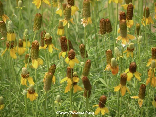
And a patch of prairie cone flowers, just because. Because what is a blog post from me without a photo of flowers????


A geocache called "Wild Blue Horses" brought us to Kamp Hill along Highway 287. 


Jim Dolan is the artist. He sculpted 39 steel wild horses on donated land as a gift to the people of Montana. The horses were completed in September 2013.


He calls them the Bleu Horses, named after blue roan horses. The horses have been partially painted blue and when the sun hits them they shine. Each weighs between 150 to 350 pounds, are 8 feet tall at the shoulders, and move (slightly) with the wind. Their tails and manes are of polyester rope. Every now and then Dolan comes back to touch up the paint and untangle their manes and tails. 


Dolan was born and raised in California, but since the age of 11 wanted to live in Montana. He went to Montana State University in the 1960s. He is well-known for his western wildlife pieces and has a studio in Belgrade, near Bozeman MT. He has created over 170 large scale public pieces world-wide. (He has a golden eagle with a 36 foot wing span in Osaka Japan.) His work ranges from table top size to the golden eagle. Jim has been working with metal for more than 40 years.

He has a herd of elk placed on the lawn of a bank in Bozeman, and a fly fisherman sculpture in Ennis. The flock of geese in the terminal of Bozeman Yellowstone International Airport is also Jim Dolan's work.


It wasn't the price of fuel, although we have been paying $3.18 to $3.24 here in MT. It was the sign for help wanted.


We were at this bakery & deli. It is also a grain elevator and I guess, a mill for grinding wheat. It was a huge operation on the outside and VERY busy on the inside. I took a peek, thinking I would buy rolls, but the line was to the door. I did not wait around. 


A little park in the downtown area of Three Forks, displaying some of its history.


Three Forks bragging rights display: Lewis & Clark, Missouri River Source, Manuel Lisa (founder of the Missouri Fur Company), and Gateway to Yellowstone National Park.