This post is about the reasons for our two night stay in Three Forks MT. Nearby was the state's oldest geocache and also the Headwaters of the Missouri River. We weren't sure how much time would be required at the two geocaches so we allowed for a whole day. They only took half a day, so we had time for some other fun which will be another blog post.
Fairweather is the oldest continuous geocache in MT. It was placed March 14, 2001.
Fairweather is a fishing access point along the Missouri River between Trident and Clarkston. Neither of the two are towns or even hamlets. They may have been at one time.
Rather than take the road posted on the sign, I was certain there was another road. There was, but it consisted of 5 miles of dirt/gravel used by the mining company at Trident. Let's just say it was scenic. We did take the 16 mile paved road back to I 90.
We drove from a valley where the confluence of the Missouri Headwaters is located to hill county of native grassland and cedar trees.
Then we dropped down into the valley and followed the Missouri River to the Fairweather fishing access point.
We found the correct trail and walked about 300 feet to find the hidden container.
A plastic ammo container. Everything was dry and in good condition. We signed the log and headed back to the parking lot. Interesting to know this geocache was rated as wheel chair accessible. It isn't.
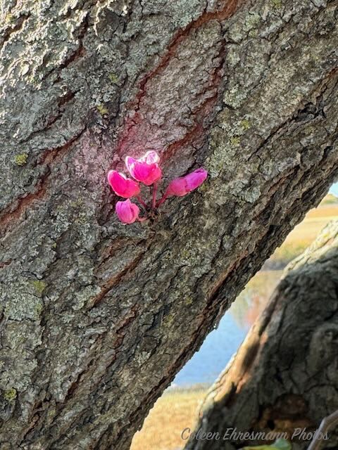
Some wild flowers I spotted along the way. There weren't many, but there weren't any poisonous plants either.
This was the boat ramp at Fairweather. Nobody was fishing at this spot. The river looked rather shallow at this point. And still very hazy from the fires in Montana and Canada, and probably other states, too.
A deserted farm house at the turn in the road at the Clarkston sign along the railroad.
Then we headed to the Headwaters State Park, which we passed to get to the Fairweather cache, using my route.
We paid our $8 fee.
We found the correct parking lot; there were two of them. When we stopped at the first one, there was a small paper sign saying there had been a bear sighting. We headed back to the other parking lot...no sign of a bear sighting. Interesting, too, because the trails from the two parking lots meet near the geocache along the Madison River.
We started out on the trail on a quarter mile plus walk.
To reach the geocache we needed to go off the main trail and head back through the trees towards the river. We each took different paths.
Although I got to ground zero (final location of the geocache container) I had some huge trees to climb over. Hubby took a different path and was able, with about 100 feet of bushwhacking, to walk right up to the ammo can hidden in the hollow of a tree. Missouri Headwaters geocache was placed March 14, 2001. Interesting how both caches were placed on the same day, but the Fairweather cache is considered the oldest.
Once the cache was found and no blood was shed or bones broken (it really was an easy walk and find) I could take photos of wild flowers. I have no idea what they are other than a type of thistle.
I bet this one is rag weed. I didn't get too close and it was off the trail, not on my path to the river.
Now with the two caches out of the way, it was time to visit the Missouri River Headwaters.
click on the photo to get a larger one for viewing & reading
The Confluence
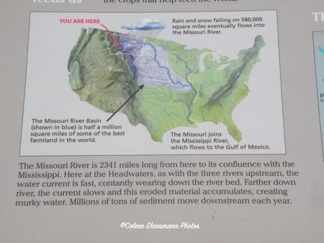
I am not certain what I was expecting, but I know I was a bit disappointed. This is it? It helped to read the signs giving more information, so I have included them in my post.
We did a geocache between Billings and Three Forks that talked about the Inland Sea.
I thought this tidbit was interesting.
This map helped put things into perspective, since I lived along or near the Missouri River the first 18 years of my life.
This was looking downstream on the Madison River. The Jefferson joined it before this point. A young man was launching an inner tube from that little island. I don't think he was planning to float to the Gulf of Mexico.
This was looking upriver on the Missouri. A couple of people fishing the warm day. It certainly isn't deep looking at the woman standing in the water with a fishing pole.
How the three rivers got their names.
Information about Sacagawea.
So far on this trip we have crossed the Madison and the Gallatin Rivers. I think we will cross the Jefferson when we head to Great Falls, our next destination.