Tuesday, August 17, 2021

Traveling from Montana to Washington

 Not much excitement as we traveled from West Glacier, Montana to Ellensburg and eventually Long Beach Washington. The big story is the smoke filled sky. And a couple interesting geocaches. 


One more huckleberry stop. These scones came from the KOA Lazy Bear Cafe as we left the campground. Very tasty. We also had one more stop at the Huckleberry Patch for some berry gifts.


We purchased fresh Flathead cherries before we left the region. These were from a stand in Hungry Horse. Also very tasty!


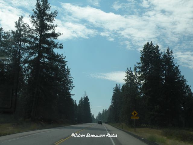
The smoke filled sky west of West Glacier Montana.


Entering Idaho at the north end, the panhandle, of the state.


A well hidden geocache. It was about 4 inches long and because it did not move, I knew it was fake. But I made Hubby grab it, just in case! LOL


The hood and truck box cover were layered with soot and ash the morning we left the campground in Idaho. I can not imagine how folks who have breathing issues are coping with the air quality right now. If this was on the truck, then it also can be in our lungs.


A fun easy geocache in Sandpoint Idaho.


We were in logging country. 


The sky was still smoke filled as we entered Washington.


And all of a sudden, BLUE SKY! CLOUDS! The first we had seen in many days! Unfortunately, it was a fleeting image. The temperature rose to the mid-90ºs.


The bridge over the Columbia River. And more smoke filled skies.


There was a small space (of clear sky, clouds, and mountain views) from the bottom of the smoke haze to the horizon. This is also a view of our bug splattered windshield and the arid landscape.


For a bit I thought maybe it was orange from fire, but I think it was sun reflection. But notice that black cloud of smoke in the area of the Yakima Valley.


Then on a very different topic ~ restroom doors. 

These were the restroom doors in a McDonalds. I had been collecting photos of restroom doors a number of years ago when my grandkids were learning to read. My rant was how would a child know which was the appropriate bathroom for them.
 

Go to this blog post to see my collection to date: Restroom Doors


Monday, August 16, 2021

Well-Kept Secrets In and Around West Glacier

 We had two nights booked on the west side of Glacier National Park. Since we had been in the park and really did not want to go back with all the traffic and tourists, we chose to explore the nearby communities before we headed west.

Driving Highway 2 on the west side of Glacier National Park. Not nearly as much smokey haze in that area on that day.


The entrance to West Glacier is much more elaborate than the east entrance.


This community is a well kept secret, in my opinion. I love the name.


I had heard of MT huckleberries from a former AZ winter neighbor. I convinced Hubby to stop for lunch. Gift store, cafe, ice cream. They have it all.


We ordered the BBQ pork with caramelized onions and cheese sandwiches for lunch. (There was also a crisp dill pickle on that lettuce leaf.) When we were done, there was no room for pie or ice cream. We would just have to come back the next day. We had some geocaching to do so we headed to Kalispell.


We found some cute, clever and creative geocaches before heading to Flathead Lake for an event.


Two geocachers from the Denver area hosted a gathering. About 12 people attended.  We met a woman cacher who plans to come to SD next month to geocache along the ND/SD border. We shared some tips as we had geocached the same area.


The event was advertised as "catch a beautiful sunset" ~ not with all the smoke rolling in! The CO guys said it had been so bad in some parts of Denver they could not clearly see the houses across the street. 

The following day we geocached in Whitefish and Columbia Falls. And as a treat we stopped in Hungry Horse.

Huckleberry ice cream, single scoop


for later, Huckleberry pie
Both treats were delicious! We also purchased some other Huckleberry products to use later. 


We drove into Glacier NP after 5 PM to get one more geocache along Lake McDonald. I posted a picture of the lake from our east to west tour. This is what the haze did to the view by the end of the week. We had one really good day for viewing mountains out of the five days we were in the area.


The other well kept secret on the west side of Glacier NP is the KOA campground. This one has a restaurant, an ice cream shop, two swimming pools, a basketball court, and other activities too numerous to mention.

We had breakfast at the Lazy Bear Cafe before we headed north for the day. We learned they would be serving steak, salmon and ribs for dinner options that evening. We made plans to be back for dinner.


We had some Huck It, Huckleberry Blonde beer, brewed locally. Hubby ordered a Flatiron steak and I ordered ribs. They were the best meals we had on our June trip and on this trip! Delicious! We would not have even tried the dinner but a couple at the next table at breakfast told us they are not camping in the park, but were told to come for the food. They told us they had eaten at the Lazy Bear Cafe the night before and "I had the best frickin' steak I have ever eaten!" I'm glad we took his advice.

Now we head west. Lots of windshield time until we reach Long Beach WA.


Sunday, August 15, 2021

North of East Glacier

 We saw all we wanted to see from the east side of Glacier National Park and since there weren't many places to explore, we headed north towards the Canadian border to find some geocaches.

I am not certain if we are heading north or south when I took this photo. The mountains are of Glacier National Park. The smokey haze is still evident.


We had not planned to cross into Alberta once Hubby read the requirements. We had our passports along, but did not plan to get a 72 hour covid test prior to crossing. This closed border crossing is at Chief Mountain.


This is Chief Mountain. It reminded us of Devils Tower in WY.  


This designation was near the border crossing at Chief Mountain. It was the first time I had seen a sign referencing the park as Waterton-Glacier. The maps given to visitors labels the national park as Waterton-Glacier.


This is the third Blackfeet Nation sign we have encountered near Glacier National Park. This sign was near the Piegan Border Crossing.


We stopped to look for a geocache similar to the one we found near East Glacier Village on similar metal art.


Hub caps are used for the eyes on all of the horses. I recognized other car parts on the native riders.


The tails of the horses are of rusted barbed wire.

While we were looking for the geocache that appears to be missing, a car drove into the parking area and asked if we could help with an online form to enter Canada. Further discussion led to helping a native mother of my age and her daughter, the age of our daughter, with completing an online form so they could visit relatives in Carway, across the border. The sad piece is, these two women had all their information in paper form, but the border guard would not accept the originals. We spent at least an hour trying to help them. The mother needed her email address for the form. She didn't remember it. The daughter had a temperamental cell phone that turned off and on when it wanted. Finally, patience won and the forms were completed, photos of paperwork uploaded, and the two of them headed back to the border. We have no idea if they were able to cross as we headed back to our campground in St. Mary.
The conversation we had with the two women was so interesting. The mother and Hubby visited while I was helping the daughter. Both mother and daughter had attended school in Flandreau SD. The mother shared the information about the 3 Blackfeet Nation metal art; one at each entrance to the land of the Blackfeet. I hope they were able to visit their family whom they had not seen in 2 years.


These bison are one of three Double T herds on land of the Blackfeet Nation. Each herd is about 300 animals and owned by billionaire businessman Joe Ricketts. Ricketts is a longtime proponent of the health benefits of bison meat, including lower fat and cholesterol. His family is the majority owner of the Chicago Cubs, which serves many bison products at Wrigley Field.


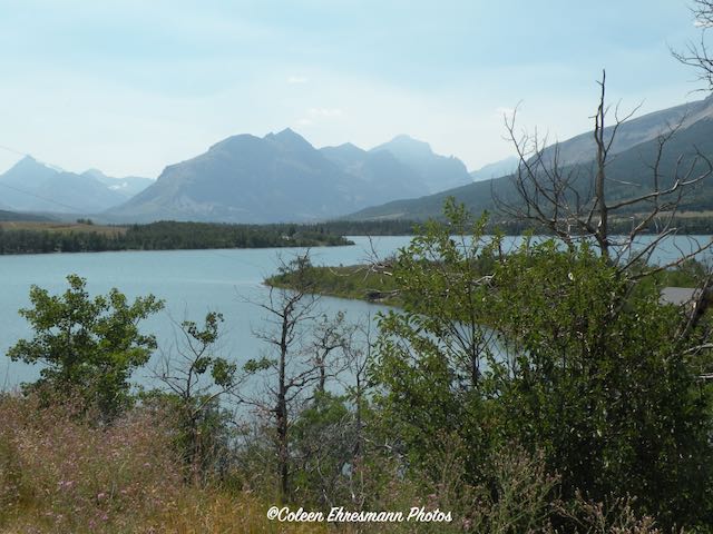
This is a photo of Lower Saint Mary Lake. It is on the north side of the road to the east entrance of Glacier National Park. (The lake in Glacier National Park is Saint Mary Lake.) The lake nor the land around it are commercialized and no houses line its shore.

We were ready to move to West Glacier and explore new-to-us territory.


Saturday, August 14, 2021

East to West Glacier National Park

 The following day we showed our Ticket-to-Ride reservation to the park entrance staff and were waved into the park. (You only get in with a day pass reservation made online MONTHS in advance, on a tour bus, or the Ticket-to-Ride reservation, also made MONTHS in advance.) We were in! For a moment I thought about telling Hubby to keep driving and bypass the parking lot for the shuttle buses. But common sense prevailed and we followed the rules.


Finally! A photo of the park sign without other people and not one through a vehicle window.


Glacier National Park is 1584 square miles of protected landscape or one million acres. The park was established in 1910 when President William Taft signed a bill into law establishing Glacier National Park. The area above the dotted line is the Waterton section of the park in Alberta. In 1932 the two parks were designated the world's first International Peace Park to commemorate the bonds of peace and friendship between two nations.


One of our shuttle buses. Some were maybe twice as long as this one. This one held 12 seated passengers. Hubby was getting info and thanking her for a fabulous ride. 

I had two reasons for wanting to go from east to west on the Going-to-the-Sun Road. The first was to see both sides of the park without having to drive and the second was for geocaching purposes. Only virtual and earth caches are allowed in national parks; there can be no containers, only look and see and record what you saw geocaches. There were 7 such geocaches along the GTTS road. My plan was to ride the entire length and determine how many of the 7 geocaches we could get by riding the shuttle. 

Our reservation was for 12 to 1 to register and get a wrist band then we could ride the rest of the day. We registered before 12 and boarded a bus immediately. We were the only two riders.

What we did NOT know was the shuttles had different stops; our first ride made 4 stops before going back to the east entrance. So we had to wait for another shuttle (about 15 minute wait) to continue our east to west journey. In 2021, the shuttles do not stop at all the shuttle stop locations due to lack of staff and maybe covid. So riding all the way to the end would help us know if we could get off at a location to find a geocache. 


Sun Point
Once we realized we had to wait for another shuttle we quickly found the trail and climbed to the top of the hill for a fabulous view of Saint Mary Lake. Some blue sky. Some clouds for photograph interest. Still some smoke from forest fires haze. 


A bicyclist with all his camping gear endangering his life on GTTS road. Brave and crazy man as the road was narrow. There was no shoulder. Ever.


This was my view at Logan Pass, the not-so mid way point on the GTTS road. The lady driver in the above photo said the east to Logan Pass was about 18 miles and Logan Pass to west was 30 miles. See that beautiful blue sky? We were in short sleeve shirts and shorts. And the parking lot at Logan's Pass was just as full. People drove around and around waiting for someone to leave. 


flowers at Logan's Pass
wild asters???
phone camera captured the lavender color where my camera does not


similar to Indian Paintbrush, but I think they have a different name
no cell service so no plant snap


This is how most of the GTTS road looked west of Logan Pass. Tree lined, starting with evergreens/firs and ending with deciduous/aspen and cottonwoods. A very different pretty. No waterfall views, but running streams.


After getting off at Apgar for a bathroom break, we boarded the shuttle to head back east. Our first stop was at Lake McDonald. One of our geocaching stops. 


But first the lodge. The lodge is a ​3 ¹⁄₂-story structure built in 1913 based on Kirtland Cutter's design. The foundation and first floor walls are built of stone, with a wood-frame superstructure. 


main room light fixture


the steps of the stairway


the timbers and the wildlife

We found the geocache location on the shore of Lake McDonald behind the lodge. We saw the line for food and drink and decided to head up the street to the store across from the shuttle stop.


flowers in front of the camp store


The west side of Glacier has less rugged mountains, fewer glaciers (like maybe none), green trees and green valleys, and many streams/rivers along the road.


The sky was perfect for photos, even through the van windows.


The elevation at Lake McDonald was 3153 feet. The elevation at Logan Pass was over 6000 feet. (last blog post) As we climbed out of the valley floor the rugged mountains were more prevalent. One would expect in a 3000' drop the road would have many switchbacks. Not so. Our driver Dan (from Sun Tour) told us the engineers had 13 switchbacks planned for the road when it was constructed in 1933. That did not please some powers that be. A new plan was developed and to this day there is one switchback on the drop from Logan Pass to McDonald Lake.


I can not find a name for this peak on my map. It was stunning because it glistened in the afternoon sunlight as we headed up towards the pass. In some of my photos, it is all glare, it was so shiny. It was near Avalanche Creek/Lake. (photo through the shuttle window)


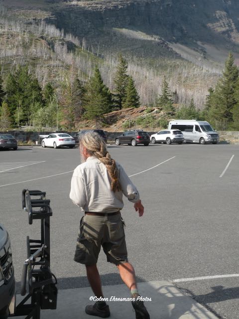
He was one of our shuttle drivers. Look at his hair! Braided dreadlocks.


There must have been a bridal photo shoot at this shuttle stop. 


This was the view at our last stop, waiting for a shuttle. We had our longest wait at the end of the day, but that was okay because we visited with a family of 5 from the Chicago area who got involved with geocaching during the pandemic year. We had lots to talk about! This was also the stop for the wedding party photo and the van driver. Before we boarded our shuttle several deer walked through the northwest corner of the parking lot. Two little fawns were in the deer party.


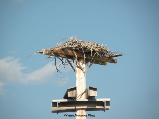
And finally, another Osprey nest. This one was at the East Glacier Visitor's Center. Again, when I became aware of the nest, there had been heads peeking out of the nest. They disappeared for the photo.

We arrived at the visitor's center about 6:30. The shuttles run until 7 PM IF you are between Apgar and the Visitor's Center.

Summary: I was disappointed in Glacier Park after the Sun Tour. Maybe it was because of the cloudy skies. Maybe it was because the tour was not all I had expected. I thought I would get some park history or information during the driver's commentary. I thought we would be driving all 48 miles of the Going-to-the-Sun Road. Maybe the non-interaction of our fellow tour riders was part of the let down. After the tour Hubby asked me how I thought Glacier compared to Yellowstone. My answer was it is like comparing Zion and Bryce. You can't because they are so different. I went back to the camper unimpressed with Glacier National Park.

Thank Goodness we followed through with the Ticket-to-Ride the next day. Although our shuttle drivers gave no commentary, every now and then one of them would point out something of interest. The sky had cleared, mostly. (It was still hazy on the east side.) The sky was blue with some clouds, making for better photos. The scenery was so different on the two sides, beautiful in their own way and making it much more interesting. We visited with mask wearing people on the shuttle buses, making the rides more interesting. I came back to the camper at the end of our half day in the park pleased, satisfied, and uplifted. The two and a half year wait and planning to see Glacier National Park was worth it.